 |
NORWAY SVALBARD Isl. |
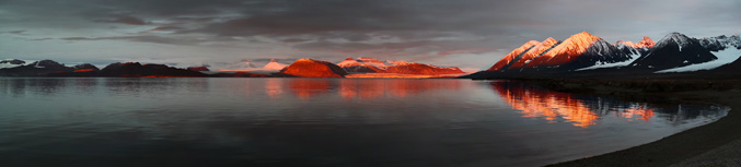
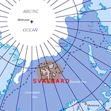
Svalbard is an archipelago between the Arctic Ocean, Barents Sea, Greenland Sea and Norwegian Sea, constituting the northernmost part of Norway. The treaty defines Svalbard as all islands, islets and skerries from 74° to 81° north latitude, and from 10° to 35° east longitude.The land area is 61,022 km2 (23,561 sq mi), and dominated by the island Spitsbergen, which constitutes more than half the archipelago, followed by Nordaustlandet and Edgeøya. All settlements are located on Spitsbergen, except the meteorological outposts on Bjørnøya and Hopen. The Norwegian state took possession of all unclaimed land, or 95.2% of the archipelago, at the time the Spitsbergen Treaty entered into force; Store Norske owns 4%, Arktikugol owns 0.4%, while other private owners hold 0.4%.
![]()